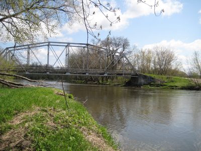
The Cannon River flows the length of the Lower Arb, and is home to many native species of fish, turtles and freshwater mussels. The Cannon River is a major watershed for southeast Minnesota, and has the water quality problems that are typical of rivers in agricultural regions. Improvements in water quality may occur in the near future, since it is the focus of conservation and cleanup efforts by such organizations as the Cannon River Watershed Partnership and The Nature Conservancy.
Spring Creek runs through the Upper Arb from Wall Street Road to Lyman Lakes. The creek is prone to spring flooding and, when flooded, carries large sediment loads from agricultural areas upstream.
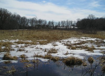
Kettle Hole Marsh in the Lower Arb is a particularly high quality marsh habitat. So far it has remained little disturbed and contains few non-native species. It is an important breeding site for frogs and toads, including at least five native species. Oxbow Pond and the wetland area at the base of Hillside Prairie are also important wetland habitats. Invasion by purple loosestrife (Lythrum salicaria) is a serious threat to the Arb’s wetlands, but so far they are relatively free of this aggressive introduced species.
The Retention Pond was created in 1999 to receive runoff from the new Recreation Center and adjacent parking lots in order to prevent rapid influx of water into the Cannon River. Runoff from the Recreation Center site is piped underground beneath Highway 19 and into the Retention Pond. From here it drains slowly into the river via underground pipe. The area around the Retention Pond has been planted with local wetland and floodplain species.
Turtle Pond was created in 1998 by excavation in a flat area that had been previously cultivated.