GIS
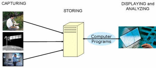
GIS, first coined as geographic information systems, is an information system for creating, storing, editing, and analyzing data related to locations on or near the Earth's surface. It provides an environment that supports not only explicit spatial thinking and reasoning, but also interdisciplinary collaborations.
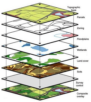
The unique character of GIS lies in storing locations as coordinates, as apposed to addresses and place names. By doing so, GIS provides capabilities that are impossible in traditional data analysis environments:
-
GIS can easily integrate data of different types and disciplines by common geography. This can be long, labor-intensive, error-prone, or an impossible task with traditional data analysis packages.
-
GIS displays data in the form of maps, which often reveals patterns and relationships not apparent in tables and charts.
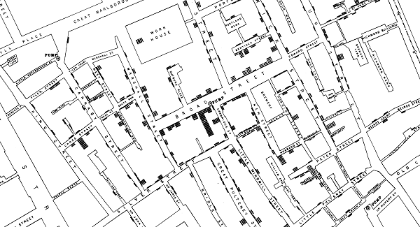
The following map of cholera deaths, created by Dr. John Snow during his investigation of the 1854 cholera outbreak in London, is a famous example of geospatial analysis. The map reveals a strong relationship between cholera deaths and a particular water pump.
- GIS allows users to explore and analyze data in numeric and geographic space. Spatial distribution of data is important to many problems we are facing, from locating a new hospital to the impacts of climate change. Traditional data analysis packages only provide capabilities to explore and analyze data in the numeric space.